|
Location:
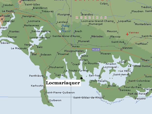
Locmariaquer, Fance. |
Grid Reference:
47� 35' 45.47" N. 3� 3' 13.57" W |
 Le Grand Menhir Bris�:
(Menhir, Alignment).
Le Grand Menhir Bris�:
(Menhir, Alignment).
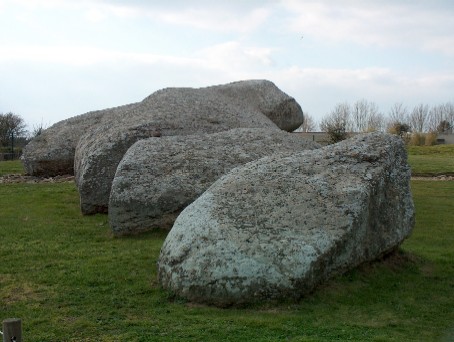
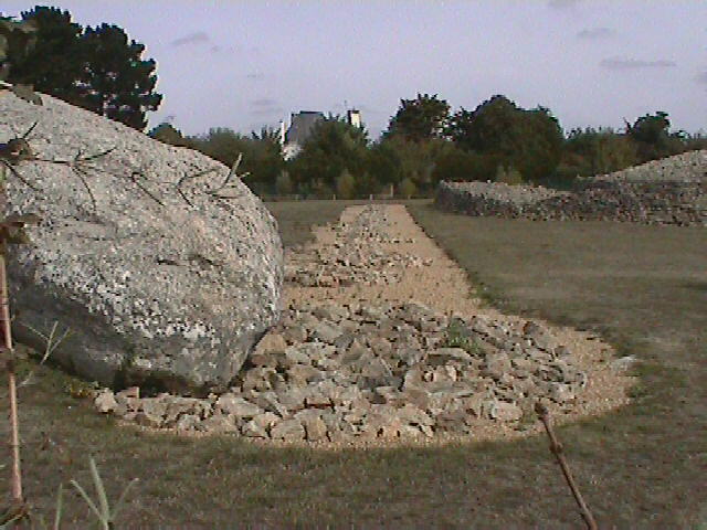
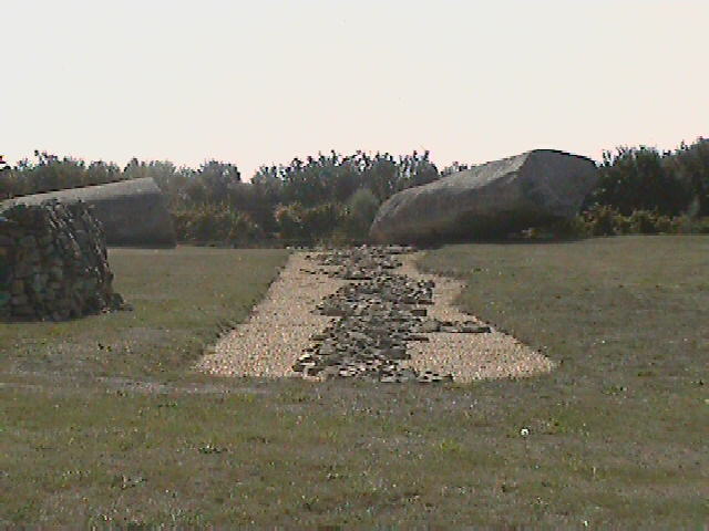
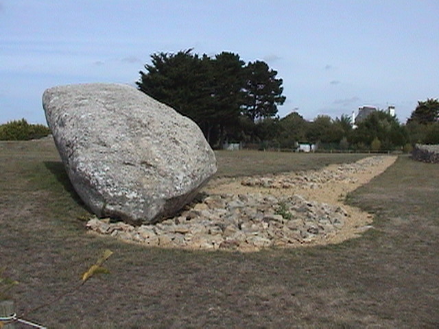
This stone has the honour of having
once been the largest (known) standing stone in Europe and the
largest of a huge 19-stone alignment. Today the menhir is broken
into four pieces which still lie where they fell.
Le Grand
menhir lies alongside
La Table des Marchands
passage-mound,
and the
Er-Grah
tumulus, both built at around 3,300 BC, following the destruction of the original alignment,
which is now suspected of having been broken up and distributed around the Morbihan area
(see below).
(Map with
site location)
|
Le Grande Menhir Bris�: ('The Big
Broken Stone', 'The Fairy Stone') |
The Locmariaquer site today:
Le Grand Menhir is one
of three structures at the Locmariaquer site. It lies beside the
Er-Grah
tumulus and the Table des Marchands,
both built around 3,300 BC. It is also the last surviving stone of an
earlier construction dating from around 4,500 BC
(6). The original
structure is thought to have been broken around 4000 BC.
|
Physical description
of the stone:
The stone, now fallen into 4 pieces, is estimated to have weighed about
355 tons when complete and to have stood over 20 metres high (1).
It was hand 'mauled' into its present shape and an axe-plough figure was
once visible on the middle fragment. John Michell reports the nearest source of similar stone at over
50 miles distance (4), and even
though newer reports suggest a distance of only 10km north of Auray
(5), it still highlights the fact that the location
outweighed the difficulties involved in transporting such large stones over long
distances.
The transport of such large stones from such a distance indicates both that
the location was important to the builders and that the type of stone was.
This same behaviour was repeated at other important megalithic sites such as
Stonehenge and
Ghiza, where quartz stones were transported
over hundreds of miles in order to be used for significant prehistoric
structures.
Worked over its entire
surface, the monument bears a sculpture representing a
"hatchet-plough". Unfortunately today this is seriously
eroded and very difficult to see.
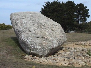 The
bottom of the stone was beautifully 'keeled'.
The
bottom of the stone was beautifully 'keeled'.
(The Top-50 megaliths of all time) |
When did Le Grand
Menhir fall?
'la Grande pierre de Locmariaker was visible from the scene of the
wreck'.
(4)
This information ties in
with the suggestion that it fell ' during
an earthquake in 1722'
(2).
The way in which the stones landed supports this theory in computer
modelling.
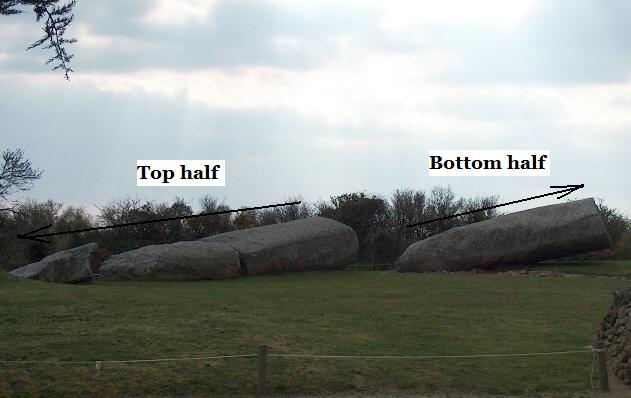
The three stones on the left
probably broke apart when the top half landed.
What was the original purpose of
the site?
The
original construction (of which Le Grand Menhir was only a component) was one
of Europe's greatest megalithic achievements.
The site was suggested by
Prof. A. Thom to have served as a lunar marker, from which it
would have been able to calculate the 18.6yr lunar cycle by observing the stone
from positions in the surrounding countryside. He predicted the
locations of the sites and found ancient markers at several of them,
confirming his hypothesis.
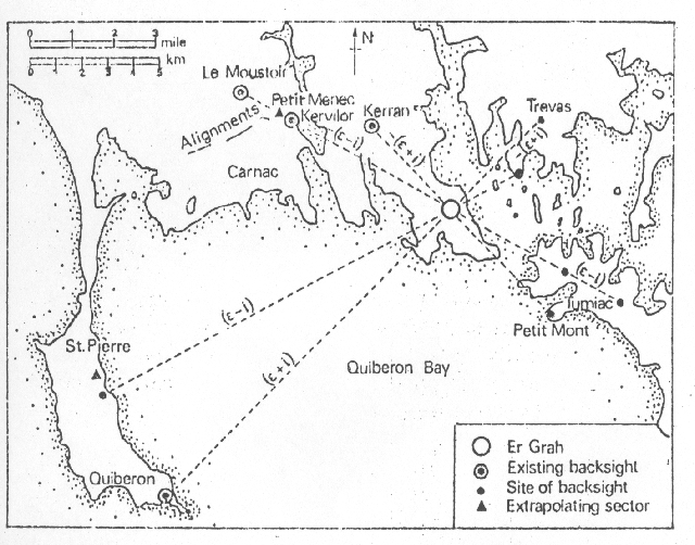
Prof. Alexander Thom concluded that it was
a huge foresight marker for the moon's rising and setting extremes. He
made predictions for the directions of eight observing points, of which
six have been shown to still have evidence of prehistoric mounds or
stones, one of which is ten miles distant.
 Another 18 stones once stood in a line of decreasing height
from
Le Grande Menhir.
Another 18 stones once stood in a line of decreasing height
from
Le Grande Menhir.
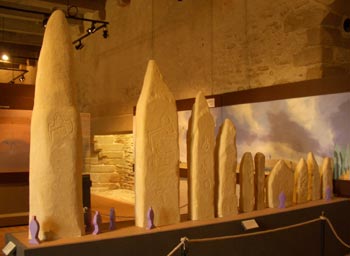
An impression of the design of the original 4,000 BC structure.
|
W here are the other Menhirs ?
In 1984, archaeologists
uncovered the hidden upper-side of the Gavr'inis capstone and found that it
bore engravings that fitted with those at La Table des Marchands, along with
another stone on top of the 'Er Vingle' or 'Er Grah' tumulus. It was concluded that the three slabs once formed a
single menhir 15m tall, which if we add another 2-3m for the missing
section, results in a stone that measures 17-18m, (which would leave approximately an
estimated 15m remaining visible above ground level).
The
length of the Le Grand menhir is 20m from end to end. If approximately 20% of
this stone was originally underground (as suggested by a guide), then we can
assume that it actually stood at around 16m above ground level.
In order to estimate the expected heights of the other
stones, we need the height of the last stone, which we can guess at being
slightly over the height of an average observer (we can suggest a height of
approximately 2m). If the tallest stood at 16m, the shortest at 2m, and with
17 others in-between, We can now estimate the difference in height between each of
the other stones. (14m / 17 = 82.353cm), a figure that is coincidentally
almost exactly one megalithic yard long
(82.966cm).
Although it is not possible to be exact about these matters, this result is not
surprising as Prof. Thom found the use of the Megalithic yard in other
constructions at Carnac.
Although the rest of the
menhirs appear to have been taken and re-used over time, parts of one remain
at the site, having been re-used for the capstones of the neighbouring
La Table des Marchands and
Er-Grah
monuments. The Table des Marchands cap-stone has several distinct
carvings on it and the discovery in 1984 of matching carvings on the
cap-stone of the
Gavrinis mound
confirmed that
the three stones fitted together until they were re-used sometime around 3,300 BC.
Other menhirs in the vicinity include the following:
-
The menhir at Man� Routuel, which is 11m long. (see J. Helgouac'h and S Cassen
- 1988)
(7)
-
The two menhirs at Man� Er-Hrouk, which are 9m and 7.5m long.
-
There are also menhirs at 'Man� Lud' and 'Petit Mont'
(Other French Menhirs)
|
Chronology:
The site shows two phases of construction. One at approximately 4,500 BC
(6),
when the initial 19 stones were placed, and the other at approximately 3,300
BC when they were re-used for other local constructions (such as the
capstone for the neighbouring passage mounds of La Table des Marchands, Gavrinis
and 'Er
Grah' tumulus).
 Archaeo-astronomy: Archaeo-astronomy:
The inter-visibility of the
sites was checked at night with the use of a light mounted on a water tower
and found to be satisfactory, thus confirming the idea that someone standing
at (the appropriate), one of the eight observing points would have seen the
moon set behind the distant spike at its major and minor 'standstills'.
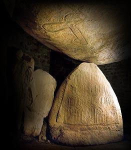
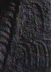
It is interesting to note that there are 19 crescent symbols on the top
edges of the end-stone inside the Table des Marchands (see left side of
photo-right). This number has been suggested as being related to the lunar
cycle which lasts 18.6 solar years, supporting the idea that the original
site functioned as a means of measuring and calculating the lunar cycles.
Le Grande Menhir Bris �: Photo Gallery.
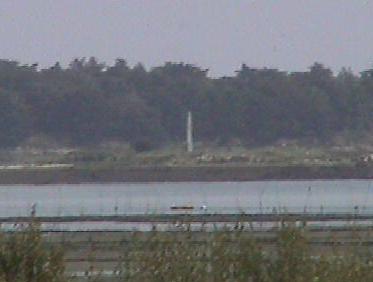
This 'observation stone' across the bay is
still visible from 'Le Grande Menhir'
(with a zoom lens).
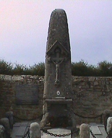
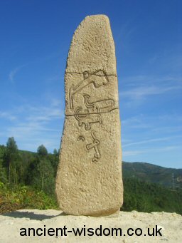
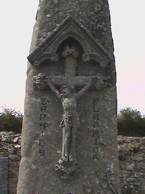 A
'Christianised' menhir in the graveyard right next to the Locmariaquer site.
(Was this one of the original stones too?)
A
'Christianised' menhir in the graveyard right next to the Locmariaquer site.
(Was this one of the original stones too?)
(Other French Sites)
(More about French
Menhirs)
|