|
Location:
Somerset, England.
(O/S -
ST 513 385) |
Grid Reference:
51�
09' N, 2� 45' W. |
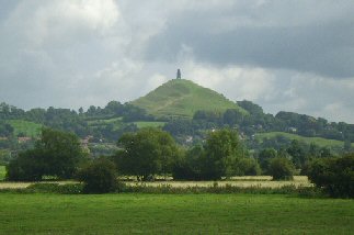
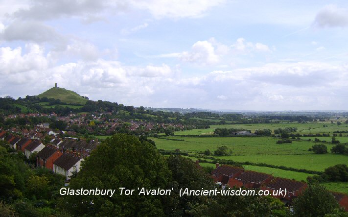
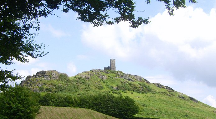
 Glastonbury Tor:
(Avalon, The 'Sacred Heart' of England).
Glastonbury Tor:
(Avalon, The 'Sacred Heart' of England).
 As well as being associated to Avalon, King Arthur, The
Holy Grail and Christianity, Glastonbury Tor sits on the St. Michael's
Ley, which has a Neolithic provenance, and is known as one of the celtic
'Perpetual Choirs', said to maintain the spiritual integrity of
Britain. As well as being associated to Avalon, King Arthur, The
Holy Grail and Christianity, Glastonbury Tor sits on the St. Michael's
Ley, which has a Neolithic provenance, and is known as one of the celtic
'Perpetual Choirs', said to maintain the spiritual integrity of
Britain.
The primeval mound (surrounded by water) was a
fundamental theme in prehistory, and Glastonbury was surrounded by water
until the Somerset flats were drained in the 4th century. The
discovery of lake-villages and raised walkways connecting Glastonbury
with the landscape illustrates that the hill was considered worthy of
attention since prehistoric times.
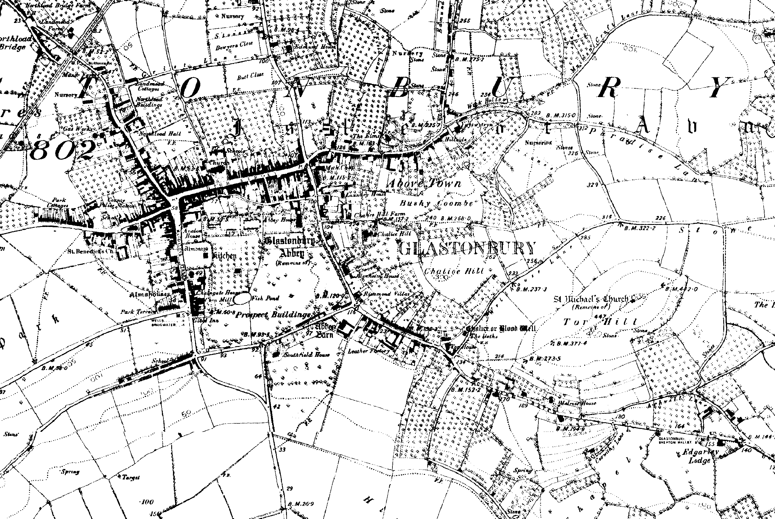
(Click here for
1888 Map of
site)
|
Glastonbury Tor: (St. Michael's Mount, Tor Hill) |
The
Celtic name of the Tor was "Ynys Witrin," or sometimes "Ynys Gutrin,"
meaning "Isle of Glass".
Glastonbury Tor
is known as the 'Heart of England', revealing a spiritual
connection that has been reinforced by association with the Arthurian
legend of Avalon, and we are reminded by John Michell that Glastonbury was
mentioned in the 'Welsh Triads' as one of ancient Britain's
'Perpetual Choirs'. (2)
|
Chronology:
Discoveries of Neolithic flint tools
from the top of the Tor demonstrate that it has been visited/inhabited
since prehistoric times.
The area is known to have
once been surrounded
by marshland and floodwater. The remains of Iron-age lake-villages nearby confirm this
and there are indications that boats could have once sailed right to the 'Tor'.
705 AD
-
King Ine founded a monastery here, which became a Benedictine house
in the 10th Century.
1184 AD -
The church which was built, according to tradition, by Joseph of Arimathea
(the man who took Jesus to his tomb), was destroyed in this year.
1190
AD -
Monks claimed to have discovered the grave of King Arthur and
Guinevere. The grave in the Abbey grounds was discovered after the secret
of the burial was revealed by a Welsh bard to King Henry II. The King then
informed the Abbot of Glastonbury and, eventually, when rebuilding the Abbey
after the fire of 1184 AD, the monks searched again for the grave. About 2m
down they found a stone slab and lead across inscribed �hic iacet
sepultus inclitus rex arturius in insula avalonia�, which means �here
lies buried the renowned King Arthur in the Isle of Avalon�. About 2.7m
below the slab was a coffin cut from a hollow log containing the bones of a
2.4m man with a damaged skull, as well as smaller bones with a scrap of
yellow hair. The original grave is 15m from the south door of the Lady
Chapel.
(1).
1278 AD
-
The bones were re-interred in a black marble tomb before the
high altar.
(1)
The
Abbey Church was built in the 13th and 14th centuries, of which substantial
remains still exist.
1539 AD - The Tor was
the place of execution of the last Abbot of Glastonbury Abbey, who was
hanged, drawn and quartered along with two of his monks.
|
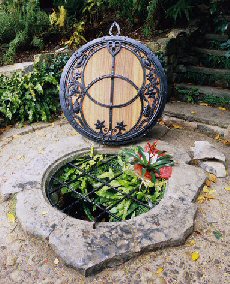
The
'Chalice' or 'Blood'
Well:
A spring-water well. (Also called �Blood
spring� because the waters are tinted with iron-oxide). Legend tells how the
shaft of the well was built of huge stones by the druids and that later, the
Chalice used at the �last supper� (the Holy Grail), was thrown into its
waters. Sir Norman Lockyer
noted that the style of construction was similar to that seen in ancient
Egypt.
Archaeo-Astronomy
-
Glastonbury lies on the
'St. Michael's ley-line' which crosses
the England along the same azimuth as the may-day sun. The
alignment is connected through several Christianised ancient sites named after St.
Michael and St. George, both of which are known as Dragon-slayers. This
combination of serpent and solar worship is reminiscent of William Stuckley's vision of the ancient (megalithic) British landscape. The Tor's association with astronomy is reinforced by extremely accurate
geometric connections with
Stonehenge.
(More about Archaeoastronomy)
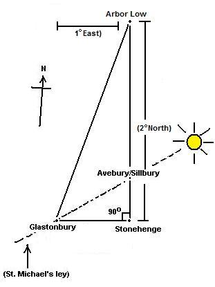
Alignments
-
Glastonbury Tor has been identified as a part
of the St. Michael's Ley Line or 'Corridor of Incidence',
which is astronomical in nature, but it is also part of a vast geometric
'decagon' discovered by John Michell and it forms a
right-angled triangle with
Avebury and
Stonehenge. (Both of these
geometric alignments are accurate to within 1/1000th parts).
This right-angled triangle also extends north to meet with
Arbor Low, which is situated remarkably at
exactly 1�
east and 2�
north of Glastonbury (see below). Glastonbury also lies on the path of numerous
ley-lines and
several other alignments traversing the English landscape.
(Map
of the St. Michaels Leyline)
(More about English Geodesy)
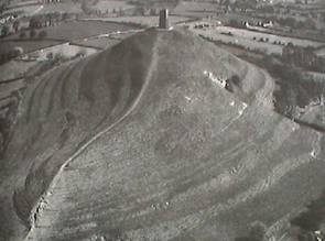
The Glastonbury 'Labyrinth'
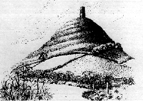 It is interesting to note that Glastonbury (and the
orientation of the tower on top) lies in-line with the St. Michaels
Ley, making it a compelling suggestion that the hill was artificially shaped
into its present form, an idea which finds favour in the seven-levelled
ritual terraced pathway that winds up the Tor. This is suggested to have
been a deliberate pathway, either designed to entrap passing spirits, which were
believed to travel in straight lines (Ley-lines) or, as a ritual pathway
(Labyrinth) for pilgrims. It is interesting to note that Glastonbury (and the
orientation of the tower on top) lies in-line with the St. Michaels
Ley, making it a compelling suggestion that the hill was artificially shaped
into its present form, an idea which finds favour in the seven-levelled
ritual terraced pathway that winds up the Tor. This is suggested to have
been a deliberate pathway, either designed to entrap passing spirits, which were
believed to travel in straight lines (Ley-lines) or, as a ritual pathway
(Labyrinth) for pilgrims.
The spiral pathway
was dated by Professor Philip Rahtz to the 3rd or 2nd
millennium BC
(3).
(More
about Labyrinths)
The area is known to have
once been surrounded
by marshland and floodwater. The remains of Iron-age lake-villages nearby confirm this
and there are indications that boats could have once sailed right to the 'Tor'.
Navigating the inland
sea at Glastonbury - The so-called �Sweet Track�, was discovered in
1970. It extended across the marsh between what was then an island at
Westhay, and a ridge of high ground at Shapwick, spanning a distance of
almost two kilometres. It is clear that this area was once thus engineered
so that it could be passed on foot. It is now known that this was but one of
a network of such tracks. Today, the Sweet Track has the honour of being the
oldest engineered road in the world and the oldest timber trackway in
Northern Europe. Tree-ring dating has concluded that it was built in ca.
3800 BC. The track consisted of crossed poles of ash, oak and lime, which
were driven into the waterlogged soil to support a walkway that mainly
consisted of oak planks laid end-to-end. Since its discovery in 1970, it has
been determined that the Sweet Track was actually built along the route of
an even earlier track, the Post Track, dating from ca. 3840 BC.
(3)
|
The Isle of Avalon.
Glastonbury
is specifically referred to as Avalon, and accredited as one of Britain's
'Perpetual Choir's' in
the 1796 edition of a translation of
FABLIAUX (TALES) which includes a four line Welsh text (known as a Triad),
and an English translation of it.
(7)
According to accounts by the
chronicler, Giraldus Cambrensis, the abbot, Henry de Sully, commissioned a
search, discovering at the depth of 16 feet (5 m) a massive hollowed oak
trunk containing two skeletons. Above it, under the covering stone,
according to Giraldus, was a leaden cross with the unmistakably specific
inscription Hic jacet sepultus inclitus rex Arthurus in insula Avalonia
("Here lies interred the famous King Arthur on the Isle of Avalon").
|
 Archaeo-Astronomy
- Archaeo-Astronomy
-
Glastonbury is on the 'St.
Michaels'
ley-line which coincides with the Mayday sunrise, crossing the longest
possible stretch of Southern Britain. The 'Leyline' runs from
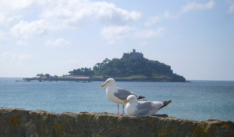
St. Michael's mount
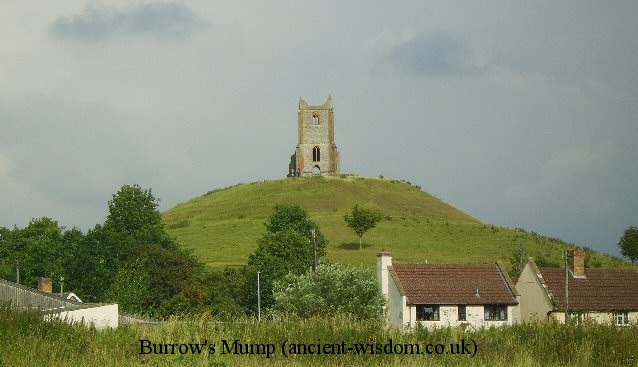
in Cornwall to Brent tor, Cadbury, Trull, Creech St Michael,
Lyng, Othery, Burrows
Mump, Glastonbury, Buckland dingham,
Avebury, Ogbourne St George, East Hendred and Bury St Edmonds (All these sites
have or had churches dedicated to the dragon-killing Saints Michael and
George). From
the church of St Michael on the �Mump� at Burrowbridge, (Burrow Mump),
Glastonbury Tor is apparently visible behind the intervening hills. Extending this
alignment eastward, one arrives at the southern entrance of Avebury.
It has been observed
that from Windmill Hill, at the winter solstice, the rising sun can be seen
to roll up the side of the Tor. A phenomenon that last
approximately half an hour.
Avebury/Silbury,
Stonehenge
and
Glastonbury form a right angled
triangle (left). The hypotenuse is formed by the 'St.
Michaels'
ley-line from Glastonbury to Avebury, which coincides with the Mayday sunrise.
This same geometry extends northwards to Arbor
Low, which sits 2� North and 1� East of Glastonbury.
Glastonbury is 1� West of Mont St. Michel
in France. It is also almost exactly 7� South and 4� East of
Callanish in Scotland.
(More about the St. Michael's
Ley-line)
|
Gallery of Images : (Glastonbury Tor). |
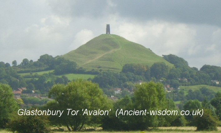
St Michaels Chapel on top of the tor,
both orientated along the direction of the St. Michaels Ley.
(Avebury/Silbury
Hill)
(The St. Michaels Ley)
(Altered Landscapes)
(Prehistoric English Geodesy)
(Other
Prehistoric English sites)
(Additional
Information about Glastonbury at SacredSites.com)
|